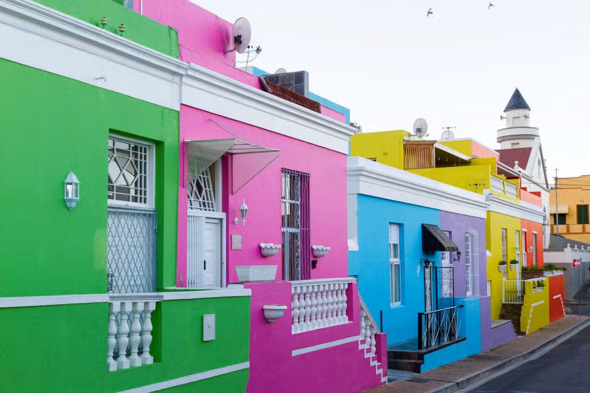
Cape Town›Hermanus›Oudtshoorn›Knysna›Greater Addo›Gqeberha (formerly Port Elizabeth)
Riepilogo del tour
Durata11 Giorni / 10 notti
ItinerarioCape Town → Gqeberha (formerly Port Elizabeth)
Tappe6 Destinazioni
Itinerario del Tour
Caricamento mappa...
Characteristics
A self-drive travel proposal that allows you to choose the hotels, car, and services you prefer. No services are included: you can also modify the stops and the number of nights as you wish. The hotels and visits mentioned in the itinerary are just a suggestion. Multiple itineraries can be combined, adding domestic flights where necessary.
Itinerary
Giorno 1 — Cape Town
Free day, we recommend visiting della città, Discovered in 1652 by the Dutch, who used it as a supply base for their ships bound for the East, Cape Town is now considered one of the most multifaceted cities in the world. It is dominated by landscapes of extraordinary beauty, where sea, mountains and countryside merge into a unique whole that leaves everyone speechless.
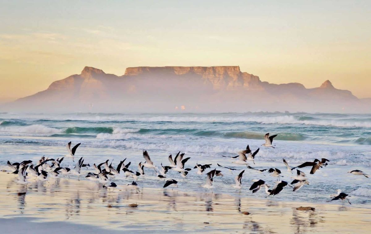
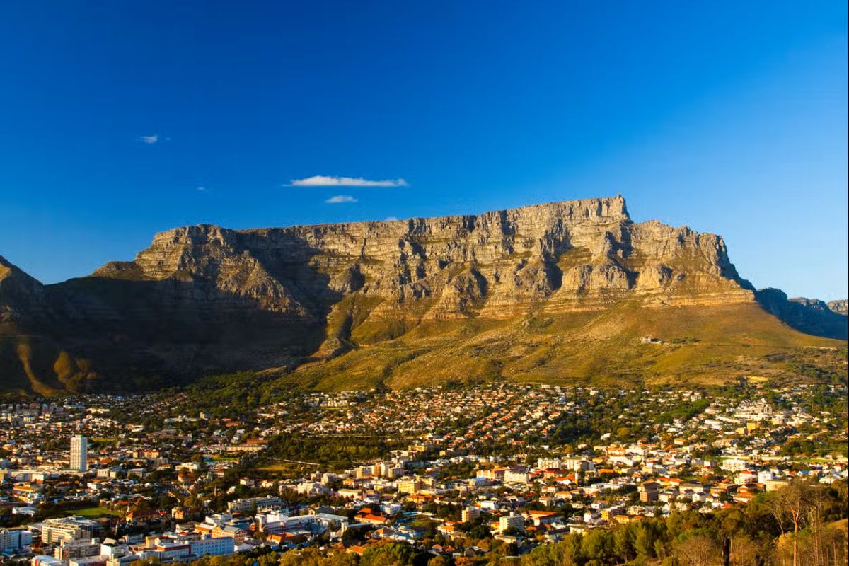
The tour begins at Table Mountain, which offers a magnificent view of the city. However, the ascent by cable car is subject to weather conditions; moreover, between July and August, the facility is closed for annual maintenance. Alternatively, you can climb Signal Hill and then continue with an orientation tour of the city.,
Giorno 2 — Cape Town
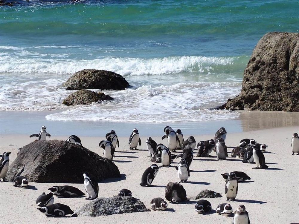
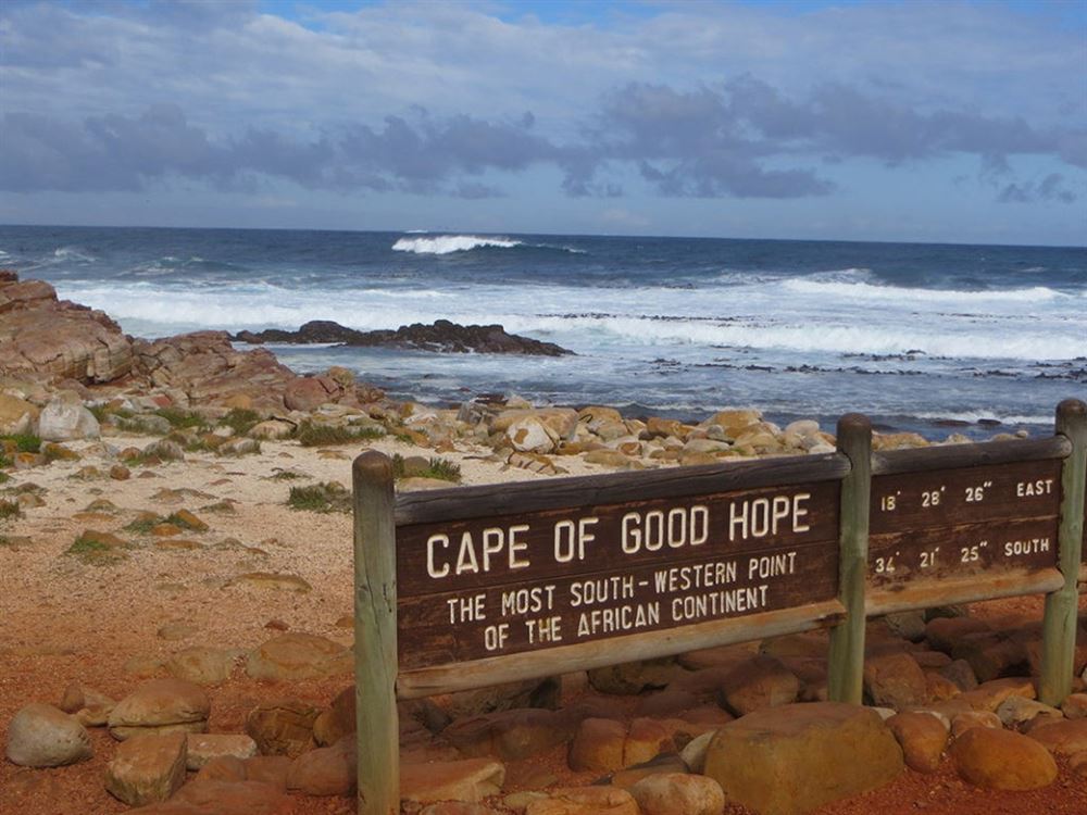
Free day, we recommend visiting Penisola del Capo, Cape Town is located on a spectacular mountainous peninsula that extends into the ocean. From the city, you can follow the Atlantic coast through the suburbs, beaches, and the Twelve Apostles promontory. In Hout Bay, you can embark on a cruise to Seal Island, an island inhabited by hundreds of Cape fur seals and cormorants. Then, you can drive along Chapman's Peak Drive, which with its 114 curves in 9 km is one of the most spectacular coastal roads in the world (subject to closure in bad weather). You will arrive at Cape Point, the famous Cape of Good Hope, the extreme tip of the peninsula where the Atlantic Ocean and the Indian Ocean meet. The first land you encounter south of the Cape is Antarctica; you can reach it by cable car. You will then reach Simon's Town for a seafood lunch. Visit the nearby Boulders Beach to see the rare African penguins, which are at risk of extinction.,
Giorno 3 — Cape Town
Free day, we recommend visiting Regione dei Vigneti, South Africa has long been a renowned producer of quality wines, especially in the Winelands area, literally "the lands of wine". The plateau, which extends from Cape Town inland and gradually rises in altitude, is a renowned wine region, considered by experts to be the best in South Africa. The magnificent mountain ranges that surround Stellenbosch and Franschhoek contribute to creating an ideal microclimate for vineyards. The first colonial settlements in this region date back to the second half of the 17th century, when the Dutch founded Stellenbosch and the French Huguenots settled in Franschhoek. Both of these cities are rightly proud of their young and innovative chefs, many of whom work at the wineries, and in recent years the region has become the driving force behind South African cuisine. Although it has long been overshadowed by the two nearby cities, the emerging Paarl deserves to be visited. Within a radius of 60 km from Cape Town, in the valleys and on the hills, the traditional Cape Dutch architecture of the Dutch settlers is in perfect harmony with the natural environment. To fully experience the Winelands, with its 600 wineries, the refined gastronomic tradition imported from Europe and enriched by local flavors, luxurious cottages and elegant boutique hotels scattered among the vineyards and the cities of Franschhoek, Stellenbosch, and Paarl, it is recommended to stay at least one night.,
Auto
Giorno 4 — Cape Town → Hermanus
Free day, Hermanus is a city in the Western Cape famous for whale watching in Walker Bay, especially between July and October. Occasionally, Humpback, Bryde's, and Minke whales can be seen, but the bay is mainly frequented by Southern Right whales. The best viewing points are the cement paths that run along the cliff from New Harbour to Grotto Beach. There are explanatory signs at three of the best observation points - Gearing's Point, Die Gang, and Bientang's Cave. In Hermanus, you can also find the Fernkloof Nature Reserve, which has over 1600 different plant species. It is worth taking a walk in the Fernkloof or Vogelgat reserves for the beautiful panoramic views they offer. Along the famous Cliff Path, Hermanus' most famous trail, you can follow the wild coast to Grotto Beach (12 km), between the sea and the mountains. It is also possible to join organized walks. In the Hemel-en-Aarde Valley, there are many visitable vineyards and the picturesque villages of Arniston, Stanford, and Elim.,
Auto
Giorno 5 — Hermanus → Oudtshoorn
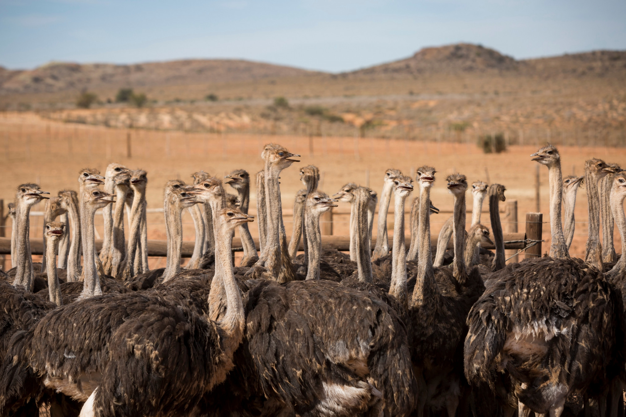
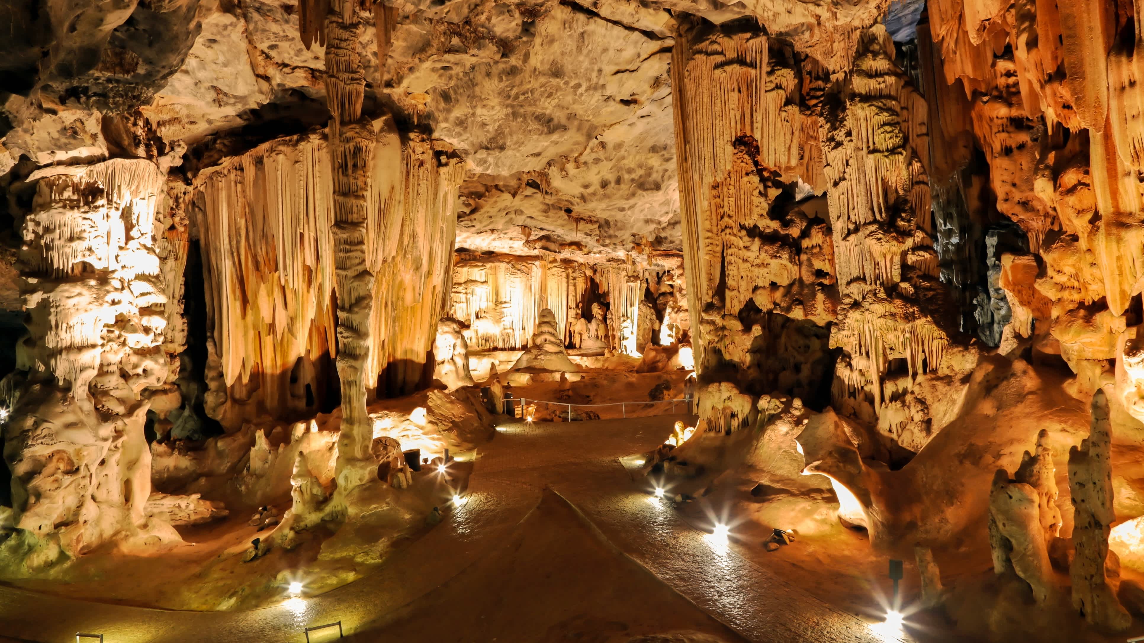
Free day, Oudtshoorn is a city located in the Western Cape region and is known for being the ostrich farming capital of the world. The city is surrounded by the beautiful Outeniqua and Swartberg mountains, which offer spectacular landscapes and numerous outdoor activities such as hiking, horseback riding, and mountain biking. Today, Oudtshoorn's ostrich farms have evolved and become a popular tourist attraction. Visitors can see ostriches up close and learn more about their life and behavior. Oudtshoorn is also famous for its limestone caves, the Cango Caves, which are located about 30 kilometers from the city and are open to the public for guided tours. These caves are considered among the largest and most spectacular in the world.,
Auto
Giorno 6 — Oudtshoorn → Knysna
Free day, Knysna boasts the most spectacular views of the Garden Route: on one side, the lagoon framed by the Karoo mountains, and on the other, the Indian Ocean crashing against the foot of the towering red cliffs. The presence of the ocean is constant and immense.,
Giorno 7 — Knysna
Free day, we recommend visiting Knysna, 90-minute cruise to Knysna Heads, the scenic strait that connects the bay to the ocean.,
Auto
Giorno 8 — Knysna → Greater Addo
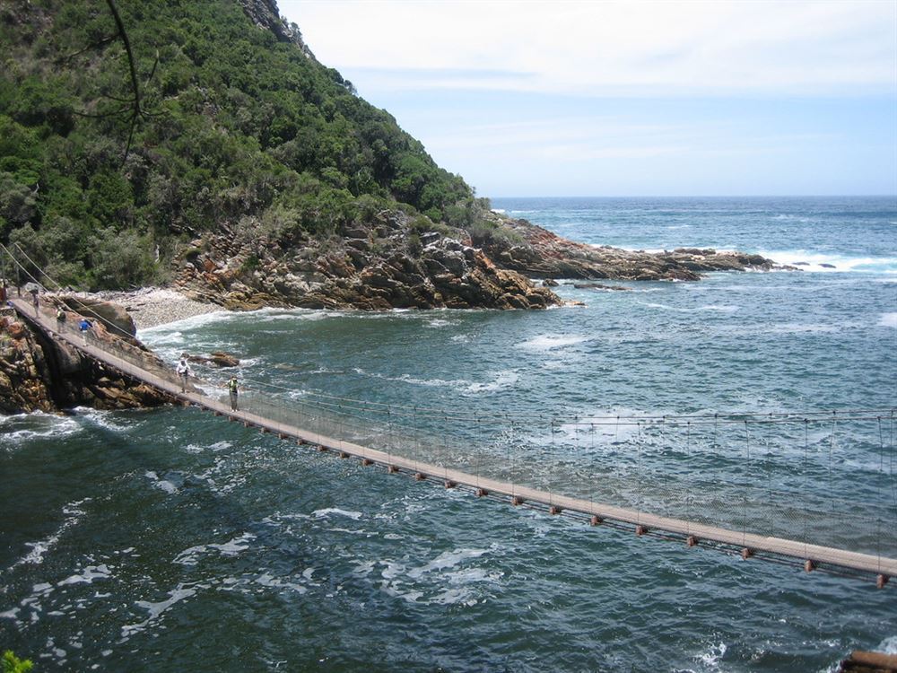
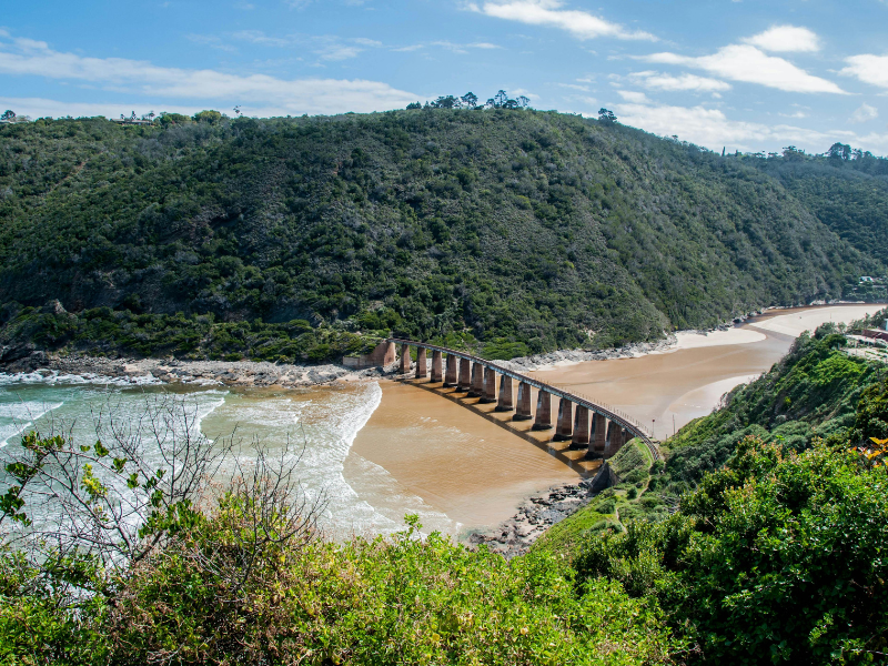
Free day, we recommend visiting parco Tsitsikamma, Tsitsikamma is the central section of the picturesque Garden Route National Park and is a Khoisan word (the language spoken by the region's first inhabitants) meaning "place with much water". Tsitsikamma encompasses 80 km of rocky coastline with spectacular views of land and sea, starting from Keurboomstrand in the west, including a marine reserve that stretches for 5.5 km into the open sea. The coastline is rugged, cut by deep gorges protected by slopes covered in fynbos and dense forest; the Outeniqua or Yellow Wood trees, Podocarpus falcata, are particularly striking. Tsitsikamma is roughly divided into two sections: De Vasselot (with the delightful Nature's Valley) in the west, and Storms River Mouth in the east. There is no direct road connecting the two sections, but it is worth taking the detour from the N2 and visiting both, although Storms River Mouth is the more spectacular of the two. To reach Nature's Valley, the only settlement in the park, take the scenic R102 or the Groot River Pass. To visit Storms River Mouth, take the indicated detour, about 60 km from Plettenberg Bay, and drive about 10 km towards the coast. All roads within the park are paved. (Note: do not confuse Storms River Mouth with Storms River Village). The easiest trail among those suggested by the park map you receive at the entrance is about 1 km long and starts from the Visitors Center, winding along the hillside with beautiful views of the sea and forest, and finally descending to the narrow mouth of the Storm River. This trail also takes you to the small beach called Mooi Beach. Crossing the suspension bridge and climbing the steep trail on the slope, the view of the ocean is excellent., in the afternoon, continuation to,
Giorno 9 — Greater Addo
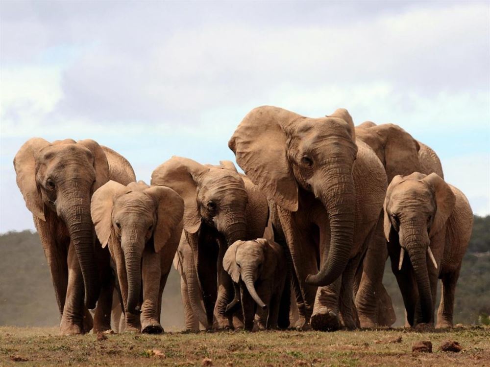
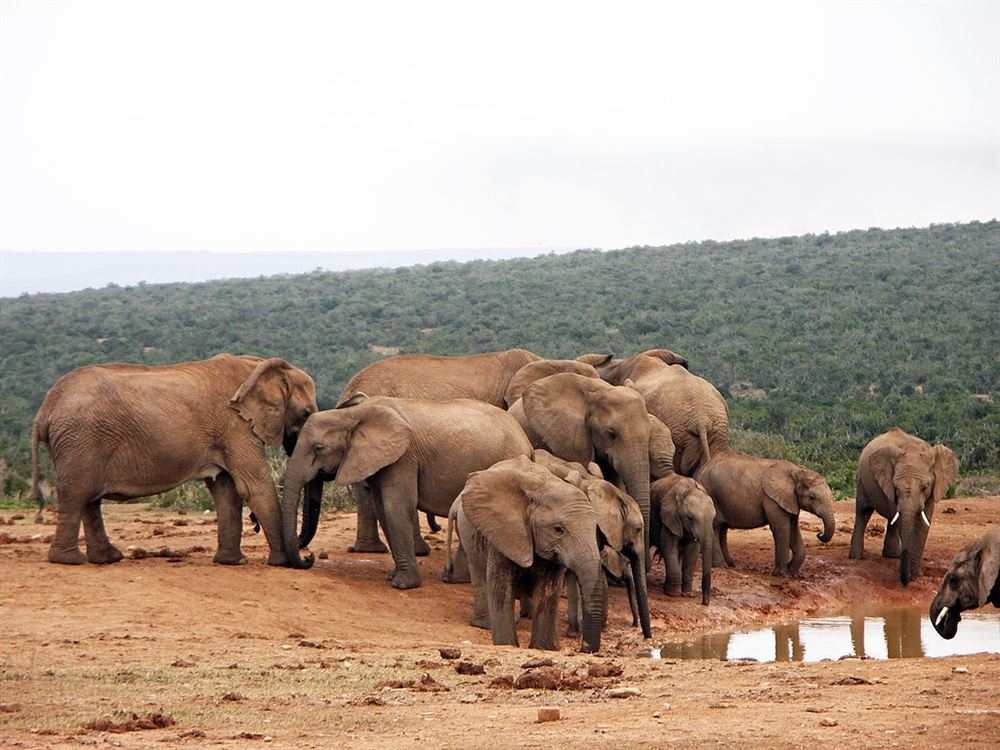
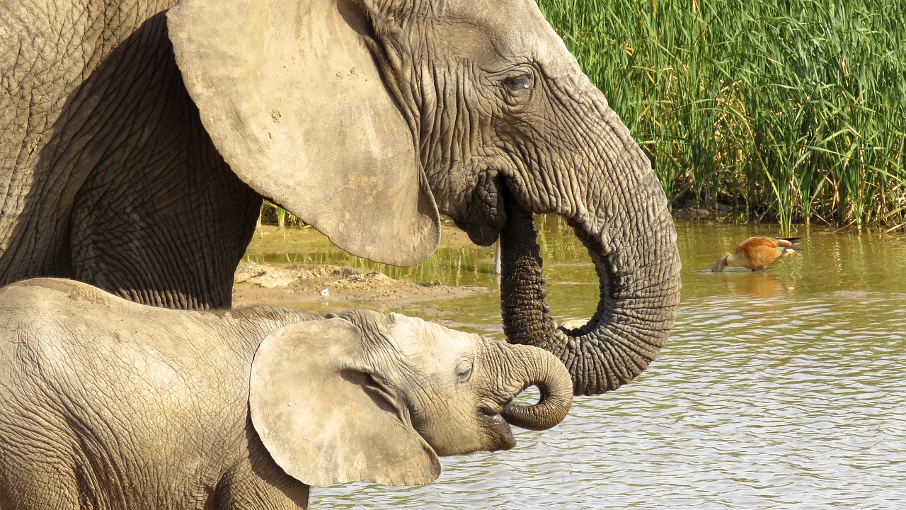
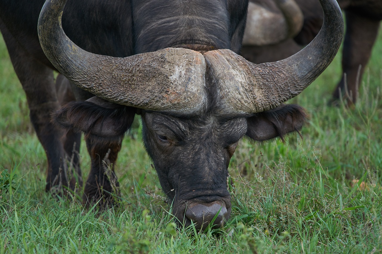
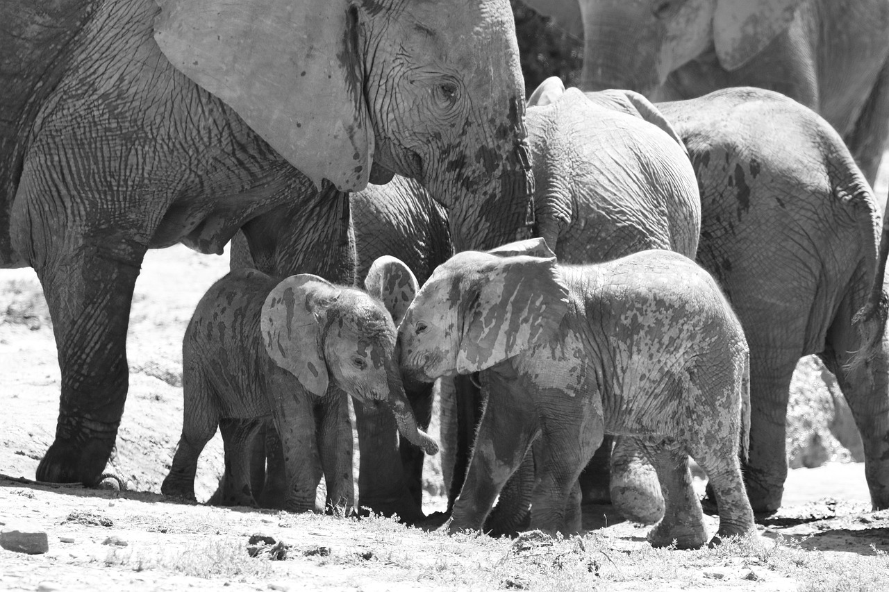
Day of photosafari in the park, Addo Elephant National Park is one of the reserves where you can spot the Big Five, just 73 km north of Port Elizabeth, with the great advantage that, unlike other major parks in South Africa, Addo is malaria-free, being located in the Eastern Cape region and also including a stretch of coastline. Elephants remain the main attraction of the park, but thanks to the presence of a small number of lions and the rest of the Big Five - buffaloes, hippos, and leopards - it has become an important reserve. Other interesting species include spotted hyenas, cheetahs, black rhinos, large antelopes such as eland, kudu, and red hartebeest, as well as warthogs and ostriches.,
Auto
Giorno 10 — Greater Addo → Gqeberha (formerly Port Elizabeth)
Ultimo fotosafari a Gqeberha (formerly Port Elizabeth), departure for, At the western end of Algoa (or Nelson Mandela) Bay, the capital of water sports in South Africa, Port Elizabeth is usually visited as a gateway to the Garden Route or one of the malaria-free reserves, not for its intrinsic beauty. In fact, the largest center in the Eastern Cape province has achieved prosperity thanks to heavy industry and cheap African labor, which has led to the formation of particularly combative unions. But it has always been a seaside resort destination for families, thanks to its 40 km of magnificent city beaches, among the cleanest and most swimmable in the country; take a walk along Kings Beach, which has earned the Blue Flag, take the children to explore the rock pools at Hobie Beach, watch the dolphin show at the Bayworld Oceanarium and Snake Park located on Beach Road in Humewood. In addition to the beaches, you can visit the Seaview Lion Park - exit 730 from the N2 Highway to Greenbushes/Seaview on Seaview Road, direction Seaview for 3 km and turn left onto Lower Seaview Road. The entrance to the Lion Park is on the left. The park allows you to enter with your car for a self-drive and gives you the opportunity to interact with lion cubs. In New Brighton, you will find Port Elizabeth's most important museum, the Red Location Museum of the People's Struggle, in a building that is also significant from an architectural point of view. You can also join some of the excellent tours that visit the townships to get an idea of the city's political history. The Campanile Memorial is worth a visit, a 52-meter-high tower on the harbor with 204 steps leading to the top. At number 7 Castle Hill, you can see one of the oldest remaining cottages, built by the early settlers, which can give you an idea of life in the 19th century.,
Giorno 11 — Gqeberha (formerly Port Elizabeth)
Free day, I fly to .,
Starts from
11 days / 6 nights - from Cape Town to Gqeberha (formerly Port Elizabeth),
_20260604170940.png)
_20260604170941.png)
_20260604171011.png)
_20260604171011.png)

_20260130093727.png)