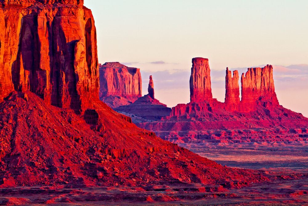
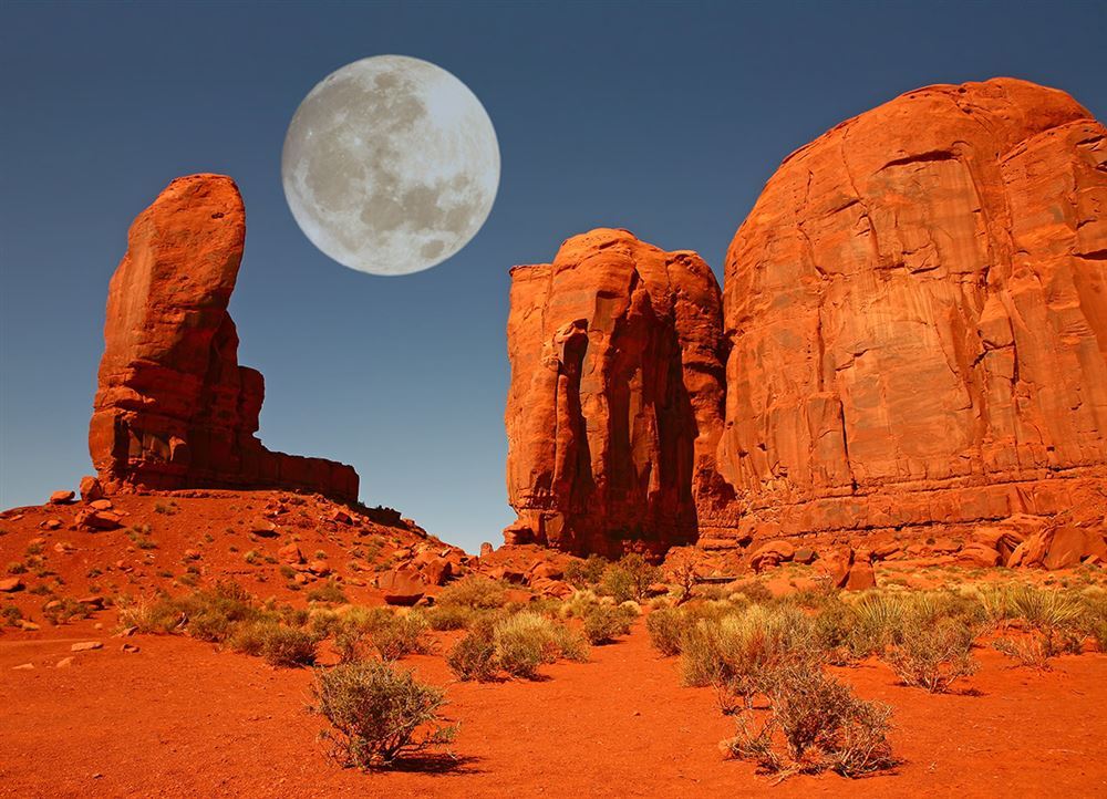
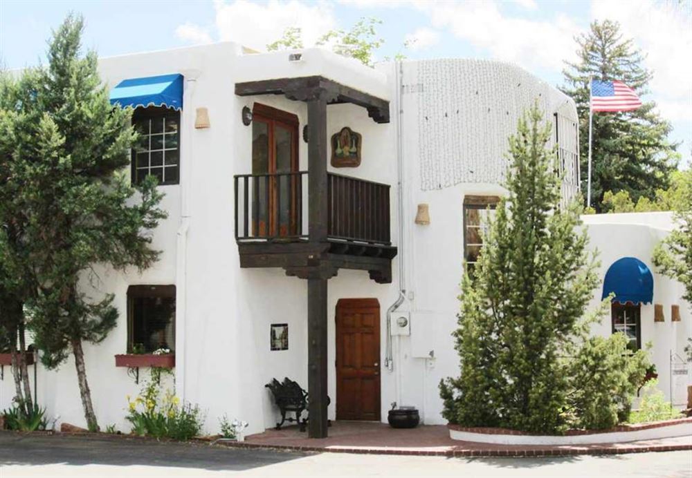
Phoenix, the capital of Arizona, is a huge urban conglomerate with countless shopping malls in the Valley of the Sun. In fact, the sun shines for almost 300 days a year, and it is scorching hot in the summer; but in the other seasons, the climate is mild and pleasant, and nearby Scottsdale, with its elegant resorts, pools, and golf courses, becomes a sought-after vacation destination.
Car
Day 4 — Chinle → Monument Valley
Monument Valley is arguably the most famous landscape of the American West – and possibly the most breathtaking one. The red sandstone crests, jutting out from the desert, were the iconic setting of numberless blockbusters – above all “Stagecoach” (1939). The park stretches over the land of the Navajo Nation, between Utah and Arizona.
Car
Day 5 — Monument Valley → Page (Lake Powell)
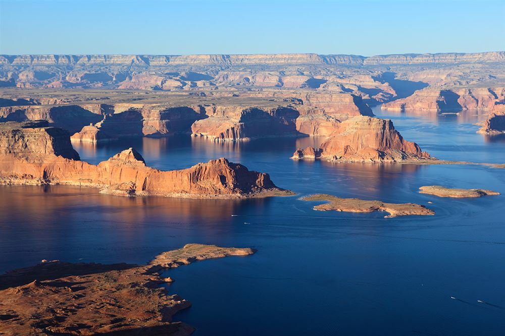
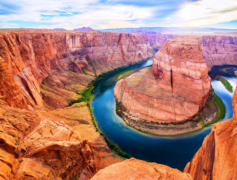
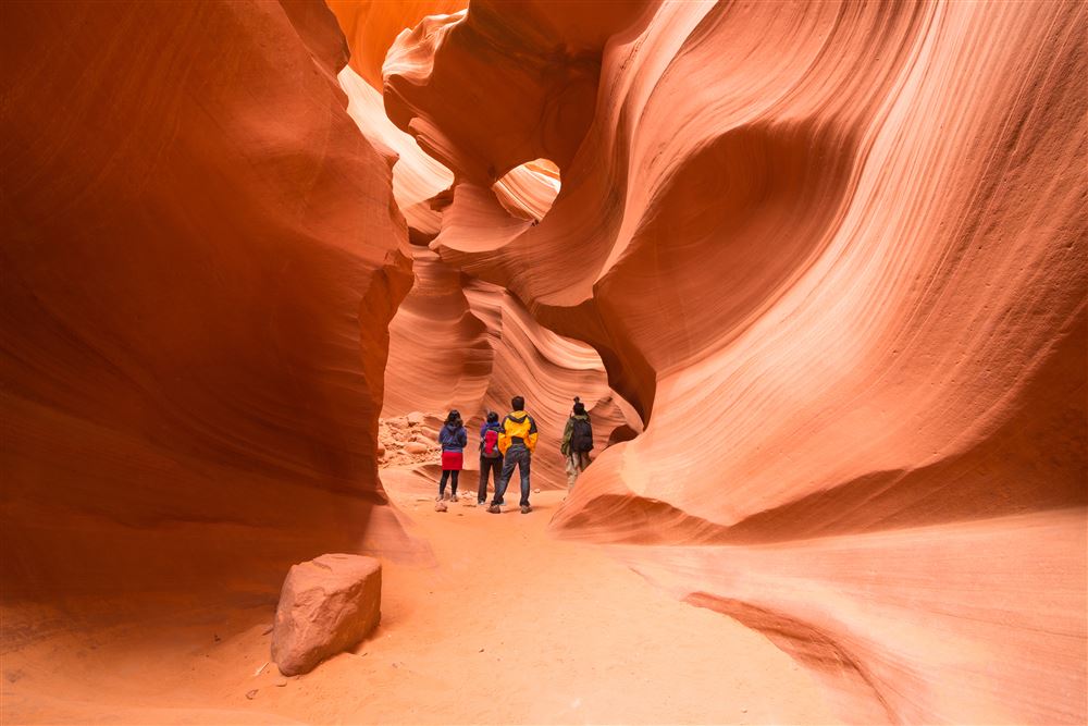
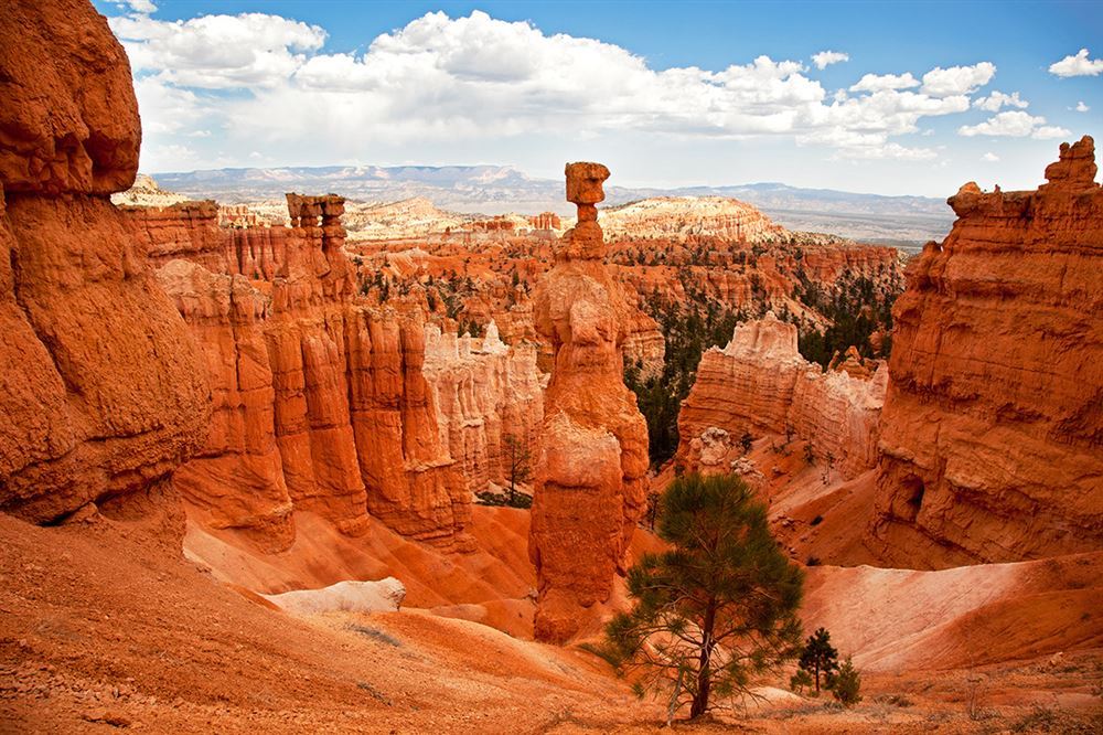
State Route 98, the Navajo Mountain Scenic Road, is a 58-mile route that stretches across part of the vast Navajo Reservation. The road takes its name from Navajo Mountain, a peak that is sacred to several tribes including the Navajo, Hopi and Paiute. The road begins at U.S. 160 a few miles northeast of Cow Springs and makes its way across desert grasslands punctuated with sandstone formations and views of Navajo Mountain. Along the way, sheep and horses graze lazily under bright blue sky. Vegetation is sparse but many of these plants play a significant role in Navajo culture. Yucca plant roots are used to make shampoo and the fruits are boiled and eaten. Other plants are used as dye for wool or to make medicinal teas. At approximately mile 18, the road continues past the Shonto Plateau and the turnoff to Navajo Mountain. A pullout provides scenic views of Navajo Mountain and the surrounding area. From here, the road curves west with more beautiful views of windswept bluff and red sandstone formations. The small community of Kaibito is located just off the road and has a small general store. The final section of the road heads northwest toward the town of Page and breathtaking Lake Powell but don't rush the journey. This scenic route feels like a step back in time and captures the incredible stark beauty of Navajo country. Before arriving at Page you should make a stop at Horseshoe Bend, just 5 miles south of downtown Page. The outlook at Horseshoe Bend is easily reached on a gently graded 2.5-km trail from a free parking lot. The path is mostly sand over hard-packed dirt. Bring water. Lake Powell was formed when the Glen Canyon Dam was erected on the Colorado river. The reservoir, surrounded by an immense desert, makes for a striking landscape – its turquoise water clashing with soaring cliffs made of red sandstone.
Car
Day 6 — Page (Lake Powell) → Bryce Canyon National Park
For your drive to Bryce Canyon today you can choose two different routes: the quicker Route 89 that crosses the Colorado River by the Glen Canyon Dam Bridge. Or you can follow the longer Route 89A, the Fredonia-Vermillion Cliffs Scenic Byway, crossing the Colorado River on the Marble Canyon bridge (take a walk on the bridge that affords a spectacular view of the water 470 feet below), passing through the stunning Vermilion Cliffs National Monument and the all American village of Fredonia. Along the way look out for the endangered California condor! Route 89A ends in Kanab and from here you follow RT 89 for about 60 miles before turning right into RT 12. Stop in Kanab to refuel and get some refreshments. Kanab was nicknamed “Little Hollywood” thanks to all the Western movies made here in the 50’s. You can also stop at Mount Carmel Junction for a slice of Ho-made pie at Thunderbird Restaurant (try the strawberry rhubarb) and at Orderville at the Orderville Mine Rock Shop, right off US-89, with a great selection of indigenous minerals, stones and gems. Just before you get to Bryce, you can make another stop at Red Canyon, for a taste of the scenic beauty that awaits you. Bryce Canyon is, in fact, not a canyon: it’s a breathtaking natural amphitheatre full of spires and arches and pinnacles, jutting out in dazzling colours against the sky, moulded by the rain and frost in bizarre shapes to create a unique mountainscape.
Car
Day 7 — Bryce Canyon National Park → Moab
The road from Bryce Canyon to Moab (about 5 hours) will be one of the most memorable of your trip if you take Scenic Byway 12. Scenic Byway 12 crosses extremely varied landscapes: remnants of ancient seabeds, the highest alpine forests on the planet, stunning red and pink rock spires, and expanses of wild sagebrush. The village of Moab stands at the very heart of the canyon region. Moab is the starting point to explore the national parks of Arches and Canyonlands, or to go rafting down the rapids of the Colorado river.
Car
Day 9 — Moab → Durango
Originally a mining town, Durango has a twofold soul: its historic district, stuck in a western past with its saloons and Victorian architecture, blends in with its contemporary soul, peaceful tree-lined avenues leading to nice organic restaurants and farm-to-table shops and markets.
Car
Day 11 — Durango → Taos
The village, protected by UNESCO, represents one of the oldest continuously inhabited communities in the United States. Visit to discover the typical pueblo lifestyle, which has remained unchanged for over 10 centuries.